The striped bass fishing app for Maine to New Jersey
StripedLines is an app built for one fish. It rates the spots on your water hour by hour from the tide, current, wind and water temperature, and gives each spot a read: why it rates the way it does, how to fish that kind of water, and what to throw.
 Sign up free
Sign up before launch and keep the founding price for as long as you subscribe.
What the app does
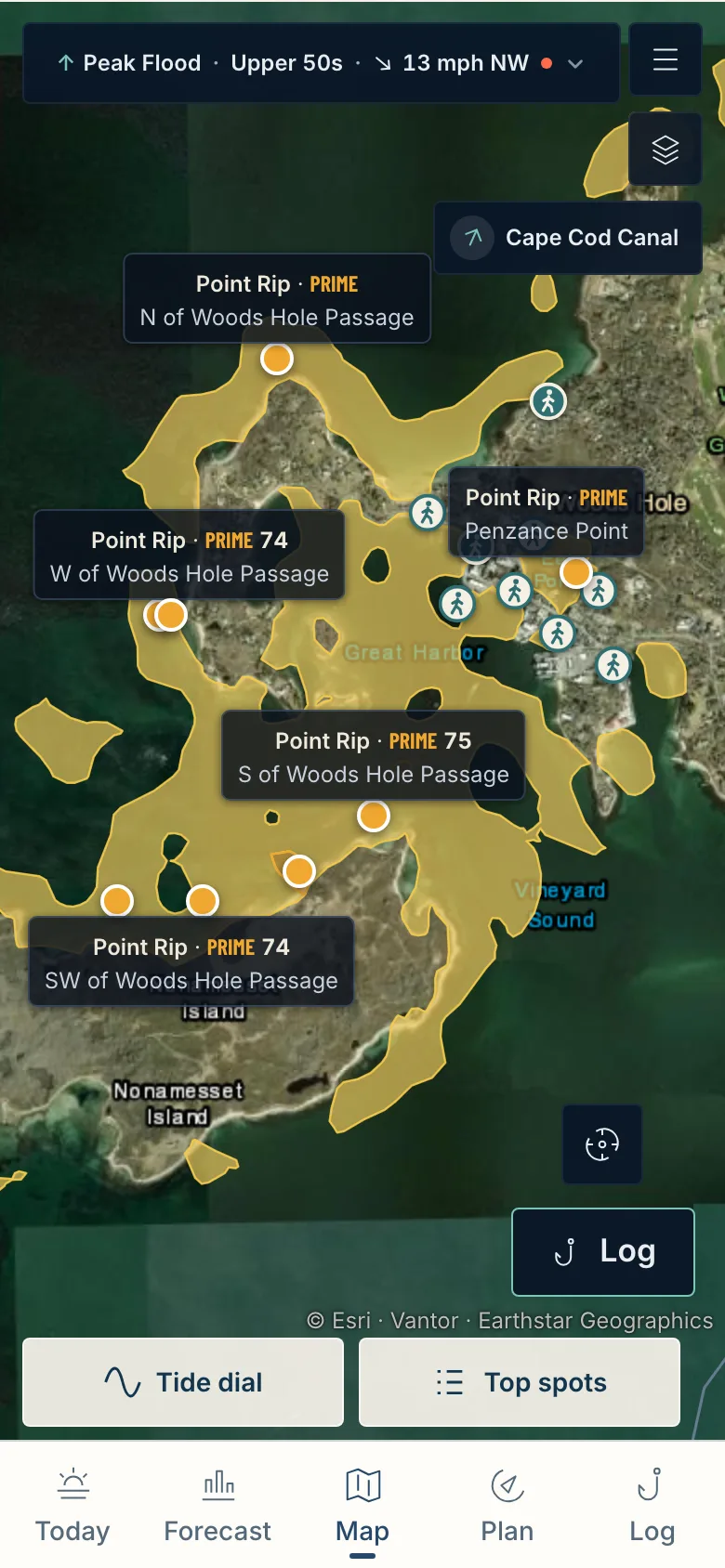
It starts on the map. The water is tinted by rating, from Dead to Fire, and the top-rated spots in view are named. Tap one for its read: why it rates that way, how to fish it, and what to throw for the bait that is likely there.
A striper forecast for today
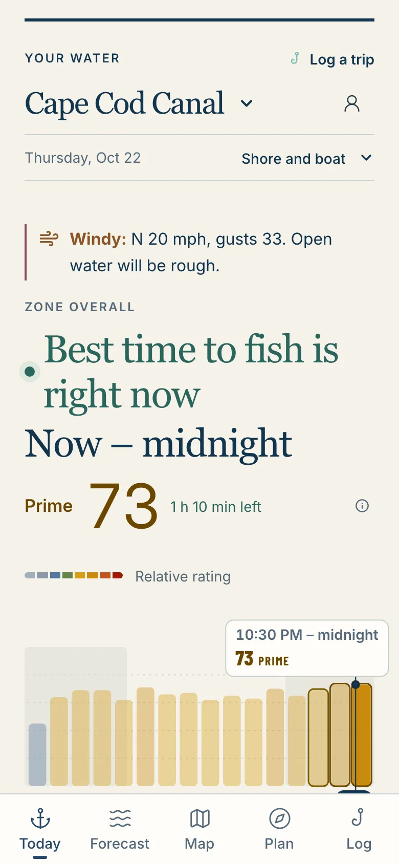
Ratings move with the tide, so the forecast is by the hour. Today shows the best window and a few places worth a look, on one screen.
A plan around the tide
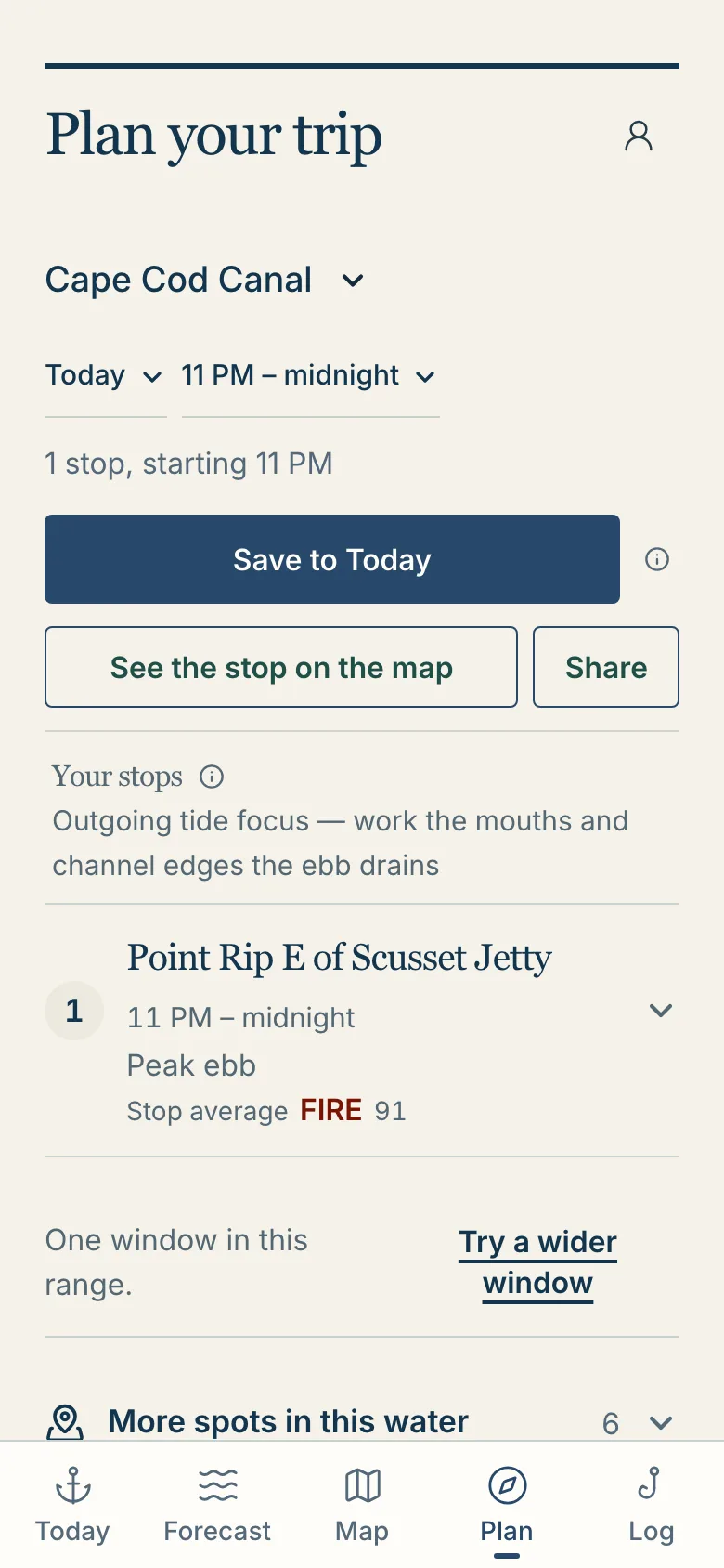
Pick the hours you have and it lays out the stops in order. When nothing looks worth the trip, it says so.
A private logbook
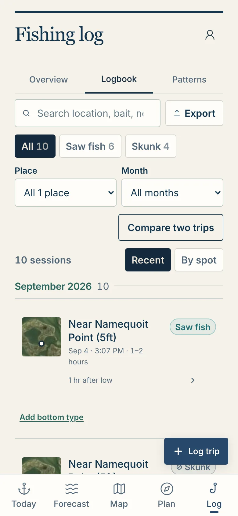
Log a trip and the tide, water, wind and light are saved with it, so you can look back at what the water was doing. Nobody else sees your log.
How it differs from a bite-score or solunar app
Most fishing apps print one number for the whole day from a moon calendar and a weather widget. The water does not work that way: the same tide can turn one piece of structure on and leave water a few hundred yards away quiet.
It rates structure, not a town
A rip, a channel edge, a flat, a creek mouth and a jetty each get their own rating, from the charted depth and shape of the bottom there and the tide and current running over it.
It is built on striper biology
It starts from how striped bass live: the water temperatures they prefer, when the spring and fall runs reach each stretch of coast, and how tide, current and light change a piece of structure through the day.
It reads the tide, not the moon phase
It shows the predicted tide and current for your day, and the sun and moon, rather than a solunar table. Why we read the tide instead of the moon phase.
It says what it does not know
When a reading is estimated rather than measured on your water, the app says so. What a rating means, and what it does not.
What to expect from it
It will not promise you a fish. A rating ranks the options in front of you against each other; it is not a probability and not a chance of catching one. The ratings are our read of the water, not a tested catch forecast, so treat a Prime or Fire window as water worth a look and expect the fishing to still be yours.
What it should do is save you the hour of cross-checking tide tables, current stations, wind and water temperature for each spot you are weighing, and tell you plainly when the day does not look worth it.
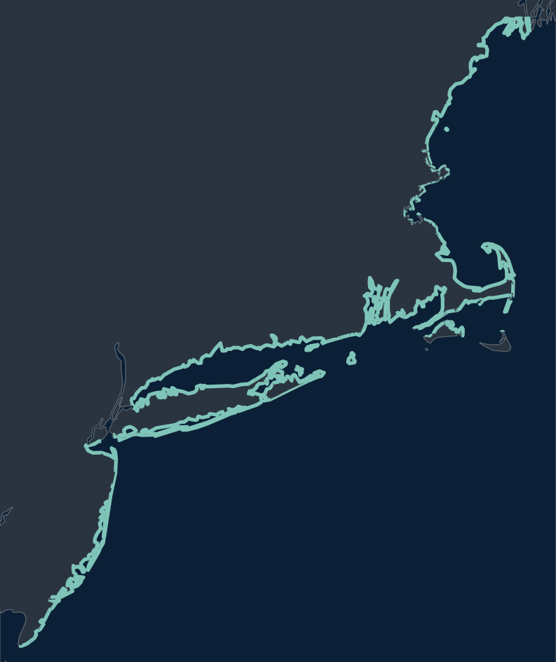
Where it works: Maine to New Jersey
1,255,078 spots rated across 121 tidal zones
Southern Maine, the New Hampshire seacoast, Massachusetts and Cape Cod, Rhode Island, Connecticut, Long Island and the New Jersey shore. New York Harbor, the Hudson and Delaware Bay are not covered yet.
Fish somewhere else? Sign up anyway: setup asks where you fish, and the water anglers name decides what we add next.
What it costs
It is free to sign up. Accounts made before launch keep the founding price for as long as they subscribe.
Already have an account? Sign in.
Free to use without an account
- Striper migration mapWhere the migrating run most likely is today, modeled daily from North Carolina to Maine.
- Striped bass bait calendarWhat stripers eat each month, by region, with the lures and flies to match.
Free tools
Questions about the app
Is StripedLines a striper bite forecast?
It rates each spot and hour in five tiers: Dead, Slow, Fair, Prime and Fire. A rating ranks the options in front of you against each other for that hour. It is not a chance of a bite and not a promise of a fish.
Is it a striper tracker app?
It does not track fish, and nobody’s catches or spots are shared. For where the migrating run most likely is today, the free striper migration map models it daily from North Carolina to Maine.
Is there an iPhone or Android app?
It runs in your phone’s browser on iPhone and Android. Add it to your home screen and it opens like an app.
Where does the striper forecast come from?
Public sources: NOAA tide and current predictions and gauges, satellite water temperature, offshore buoys, weather forecasts and nautical charts. When a reading is estimated rather than measured on your water, the app says so.
Is my fishing log private?
Yes. Your trips, catches, photos and saved spots are yours. They are not shared with other anglers, not used to recommend your water to anyone else, and not sold.